-
National Geographic Pocket Guide to Wildflowers of North America
Catherine Herbert Howell
Paperback (National Geographic, April 1, 2014)With this basic beginner's field guide to North American wildflowers, all who enjoy nature and the outdoors can identify common wildflowers, from backyard weeds to dainty forest blossoms. In a logical, user-friendly, highly visual format, this new title offers key facts about 160 of the most common wildflowers and weeds, coast to coast, including Canada and Alaska. To help with identification, each of the 160 entries has both a color photograph showing the plant in context and a color illustration showing the blossom close-up. This book is the perfect starting point for anyone, young or old, interested in learning how to identify wildflowers.
-
The Wisdom of Wolves: Lessons From the Sawtooth Pack
Jim Dutcher, Jamie Dutcher, Marc Bekoff Ph.D.
Hardcover (National Geographic, March 6, 2018)From the world-famous couple who lived alongside a three-generation wolf pack, this book of inspiration, drawn from the wild, will fascinate animal and nature lovers alike.For six years Jim and Jamie Dutcher lived intimately with a pack of wolves, gaining their trust as no one has before. In this book the Dutchers reflect on the virtues they observed in wolf society and behavior. Each chapter exemplifies a principle, such as kindness, teamwork, playfulness, respect, curiosity, and compassion. Their heartfelt stories combine into a thought-provoking meditation on the values shared between the human and the animal world. Occasional photographs bring the wolves and their behaviors into absorbing focus.
-
National Geographic: Pacific Crest Trail Wall Map in gift box Wall Map
National Geographic Maps - Reference
Map (National Geographic Maps, June 15, 2018)National Geographic's map of the Pacific Crest Trail is ideal for fans and hikers of this magnificent National Scenic Trail. It makes a great planning tool or as reference to track progress on the 2,600 plus mile length. This beautiful map shows the entire length of the trail from Mexico to Canada through California, Oregon, and Washington. A unique elevation profile highlights the trail's peaks and valleys, and an informative mileage chart shows the distance between key locations. Also highlighted on this map are passes, peaks, national forests, national parks, state parks, and Indian reservations. Additional points of interest include lodges and campgrounds near the trail.The map is packaged in a full color box that is perfect for gift giving. The box includes details about the map with its size and scale as well as a large section of the map that displays the cartography found inside.Map Scale = 1:1,700,000Sheet Size = 18" x 48"
-
National Geographic Concise History of the World: An Illustrated Time Line
Neil Kagan
Hardcover (National Geographic, Sept. 3, 2013)From the dawn of humankind to today's global complexities, this monumental volume presents world history from an original perspective that provides fresh insights with every colorful spread. Few references are as invaluable, all-inclusive, and satisfying to browse. For readers of all ages, world history is easily accessible, depicted as never beforeso that events occurring simultaneously around the world can be viewed at-a-glance together. For example, Texas Instruments launched the pocket calculator the same year the Soviet Union launched the first manned space station, in 1971. Columbus sailed from Spain the year Martin Behaim constructed a terrestrial globe in Nuremberg. The California Gold Rush followed the Irish Potato Famine in the 1840s, and the Greek dictatorship of Papadopoulos is overthrown the same year Emperor Haile Selassie of Ethiopia is deposed and U.S. president Nixon resigns, in 1974. The book's innovative time line truly sets it apart, allowing readers to scan across a spread and explore a single area or compare contemporary societies across the globe. This remarkable resource also contains dozens of maps; scores of sidebars; hundreds of illustrations; and thousands of events, milestones, personalities, ideas, and inventions. Throughout, vivid illustrations depict artworks, artifacts, portraits and dramatic scenes, while sidebar topics range from local customs and lifestyles to the effect of climate change on human migration. Drawing on National Geographic's vast resources, this concise yet comprehensive, one-of-a-kind work is as rewarding as it is compulsively readable.
-
When Women Ruled the World: Six Queens of Egypt
Kara Cooney
eBook (National Geographic, Oct. 30, 2018)This riveting narrative explores the lives of six remarkable female pharaohs, from Hatshepsut to Cleopatra--women who ruled with real power--and shines a piercing light on our own perceptions of women in power today.Female rulers are a rare phenomenon--but thousands of years ago in ancient Egypt, women reigned supreme. Regularly, repeatedly, and with impunity, queens like Hatshepsut, Nefertiti, and Cleopatra controlled the totalitarian state as power-brokers and rulers. But throughout human history, women in positions of power were more often used as political pawns in a male-dominated society. What was so special about ancient Egypt that provided women this kind of access to the highest political office? What was it about these women that allowed them to transcend patriarchal obstacles? What did Egypt gain from its liberal reliance on female leadership, and could today's world learn from its example? Celebrated Egyptologist Kara Cooney delivers a fascinating tale of female power, exploring the reasons why it has seldom been allowed through the ages, and why we should care.
-
Isle Royale National Park
National Geographic Maps - Trails Illustrated
Map (National Geographic Maps, Jan. 1, 2006)• Waterproof • Tear-Resistant • Topographic MapA rugged and isolated island on Lake Superior, Isle Royale offers unparalleled opportunities for hiking, backpacking, boating, paddling, and scuba diving in solitude, far from the sights and sounds of civilization. National Geographic's Trails Illustrated map of Isle Royale National Park delivers unmatched detail and valuable information to assist you in your exploration of this remote wilderness. Created in partnership with local land management agencies, this expertly researched map features key areas of interest including Passage Island, Rock Harbor, Windigo, and many shipwreck sites.Whether day hiking or backpacking to remote campsites, the map's clearly marked trails with mileage between intersections will help you choose the route that's right for you. The map base includes contour lines and elevations for summits and lakes, as well as soundings of Lake Superior. Boaters will appreciate the handy water mileage chart. Recreation features are clearly marked, including campgrounds, interpretive trails, lighthouses, lookout towers, ferry routes, docks, and seaplane anchorages. A variety of helpful information about camping, fishing, and boating in the region is included as well.Every Trails Illustrated map is printed on "Backcountry Tough" waterproof, tear-resistant paper. A full UTM grid is printed on the map to aid with GPS navigation.Other features found on this map include: Blake Point, Cumberland Point, Feldtmann Ridge, Isle Royale, Siskiwit Bay, Sugar Mountain.Map Scale = 1:50,000Sheet Size = 37.75" x 25.5"Folded Size = 4.25" x 9.25"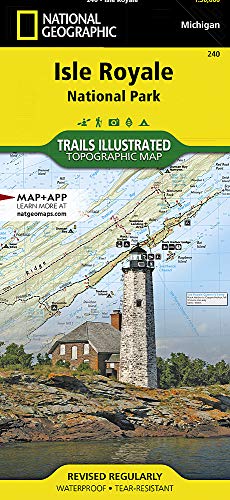
-
Glacier and Waterton Lakes National Parks
National Geographic Maps - Trails Illustrated
Map (National Geographic Maps, Jan. 1, 2009)• Waterproof • Tear-Resistant • Topographic MapNational Geographic's Trails Illustrated map of Glacier and Waterton Lakes National Parks offers unparalleled detail for outdoor enthusiasts exploring the pristine landscape of forests, mountains, lakes, and meadows within these two spectacular parks. Created in partnership with local land management agencies, this expertly researched map features key areas of interest including Many Glacier, Great Bear Wilderness, Flathead National Forest, Hungry Horse Reservoir, Lake McDonald, Flathead River, St. Mary Lake, Akamina-Kishinena Provincial Park, and the Waterton Lakes. The Glacier and Waterton Lakes map is an invaluable resource for exploring the more than 800 miles of mapped trails within the parks, including the Pacific Northwest Trail, the Continental Divide Trail, and recommended biking trails. Recreation features are clearly marked, including campgrounds, trailheads, interpretive trails, fishing and boat access, and horse rental locations. The map base includes contour lines and elevations for summits, passes and major lakes. A variety of helpful information about recreation activities available in the parks, hiking and backcountry camping, regulations, and safety tips are included as well.Every Trails Illustrated map is printed on "Backcountry Tough" waterproof, tear-resistant paper. A full UTM grid is printed on the map to aid with GPS navigation.Other features found on this map include: Apgar Mountains, Bowman Lake, Flathead National Forest, Flathead Range, Glacier, Great Bear Wilderness, Kintla Lake, Lake McDonald, Lake Sherburne, Lewis & Clark National Forest, Lewis Range, Livingston Range, Lower Saint Mary Lake, Mount Carter, Mount Cleveland, Mount Saint Nicholas, Mount Stimson, Saint Mary Lake, Upper Waterton Lake, Whitefish Lake.Map Scale = 1:100,000Sheet Size = 37.75" x 25.5"Folded Size = 4.25" x 9.25"
-
Food Journeys of a Lifetime: 500 Extraordinary Places to Eat Around the Globe
National Geographic
Hardcover (National Geographic, Oct. 20, 2009)For pure pleasure, few experiences are as satisfying as a chance to explore the world’s great culinary traditions and landmarksand here, in the latest title of our popular series of illustrated travel gift books, you’ll find a fabulous itinerary of foods, dishes, markets, and restaurants worth traveling far and wide to savor.On the menu is the best of the best from all over the globe: Tokyo’s freshest sushi; the spiciest Creole favorites in New Orleans; the finest vintages of the great French wineries; the juiciest cuts of beef in Argentina; and much, much more. You’ll sample the sophisticated dishes of fabled chefs and five-star restaurants, of course, but you’ll also discover the simpler pleasures of the side-street cafés that cater to local people and the classic specialties that give each region a distinctive flavor.Every cuisine tells a unique story about its countryside, climate, and culture, and in these pages you’ll meet the men and women who transform nature’s bounty into a thousand gustatory delights. Hundreds of appetizing full-color illustrations evoke an extraordinary range of tastes and cooking techniques; a wide selection of recipes invites you to create as well as consume; sidebars give a wealth of entertaining information about additional sites to visit as well as the cultural importance of the featured food; while lively top ten lists cover topics from chocolate factories to champagne bars, from historic food markets to wedding feasts, harvest celebrations, and festive occasions of every kind. In addition, detailed practical travel information provides all the ingredients you’ll need to cook up a truly delicious experience for even the most demanding of traveling gourmets.
-
National Geographic: United States Executive Wall Map
National Geographic Maps - Reference
Map (National Geographic Maps, Feb. 22, 2018)National Geographic's Executive reference map of the United States features all 50 States with insets for Alaska and Hawaii in antique-executive cartographic style. Each state is colored to clearly define borders and shaded relief accentuates geographical features. All major cities, transportation routes, state boundaries, National Parks, lakes and rivers, and mountain ranges are clearly displayed and labeled.Poster sized maps make a perfect addition to any sized space. They are specially designed to maximize content in a smaller footprint than standard wall maps and fit precisely into precut poster sized frames which makes finishing and hanging them a breeze. The map is packaged in a two inch diamater clear plastic tube. The tube has a decorative label showing a thumbnail of the map with dimensions and other pertinent information. Map Scale = 1:5,410,000Sheet Size = 36" x 24"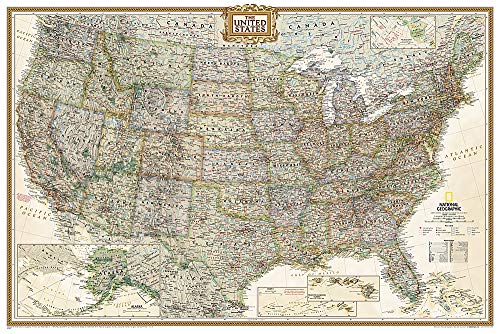
-
Mars: Our Future on the Red Planet
Leonard David, Ron Howard
Hardcover (National Geographic, Oct. 25, 2016)The next frontier in space exploration is Mars, the red planet. National Geographic goes years fast-forward to take a peek into the gravity-defying world of outer space with stunning photography, amazing visuals, and strong science. This companion book to the National Geographic Channel series dramatizes the next 25 years as humans land on and learn to live on Mars. Filled with vivid photographs taken on Earth, in space, and on Mars; arresting maps; and commentary from the world’s top planetary scientists, this fascinating book will take you millions of miles away—and decades into the future—to our next home in the solar system.
-
National Geographic: United States Explorer Wall Map - Laminated
National Geographic Maps - Reference
Map (National Geographic Maps, Oct. 13, 2015)The United States Explorer map is a classic example of the cartographic excellence National Geographic is known for. This colorful political map clearly shows state boundaries, capitals, major highways, rivers, lakes, and many major cities. Insets show detail of Alaska and Hawaii. The color palette is vibrant and stunning shaded relief provides additional texture and detail.The map is encapsulated in heavy-duty 1.6 mil laminate which makes the paper much more durable and resistant to the swelling and shrinking caused by changes in humidity. Laminated maps can be framed without the need for glass, so the fames can be much lighter and less expensive. Map Scale = 1:6,396,000Sheet Size = 32" x 20.25"
-
National Geographic Family Reference Atlas of the World
National Geographic
Hardcover (National Geographic, Sept. 29, 2015)Maps have been around in some form or other since humans first understood the need to record their physical space, and for the past hundred years, the National Geographic Society has been at the forefront of mapmaking. This Fourth Edition of our popular Family Reference Atlas of the World brings you the world and its marvels—through maps. Using the latest technological advances, satellite data has been compiled to create some 1,400 images—maps, diagrams, graphs, and tables, as well as National Geographic’s signature color photographs—to allow you to examine the most remote corners of the globe. In an era when political, health, climatic, and environmental crises anywhere on the globe can affect our daily lives, maps provide a time-honored way to navigate the realities we face. With this atlas, you hold a powerful yet accessible tool to understanding the interplay of global forces at work in the fast-changing but always miraculous planet that is our home.